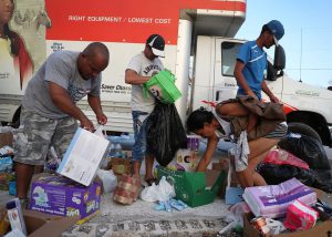
Hurricane Irma victims accept relief items on Sunday in Marathon, Florida. Joe Raedle/Getty Images
Accessibility to transparent, up to date data has proven to play a critical role in both individual- and community-level capacity to prepare for, respond to, and recover from disaster events, such as a hurricanes— Something that was especially evident following Hurricane Katrina.
Denice W. Ross, a Public Interest Technology Fellow at New America and a co-founder of the Obama administration’s Police Data Initiative, spent more than a decade in New Orleans building community capacity to use government data and is continuing to broaden her work in the “open data” space by aggregating high-value data sets that can aid communities impacted by disaster.
In a recent article published by
Slate, Ross notes that for those community members affected by a hurricane, data transparency can make recoveries more predictable, fair, and efficient. Ross continues by saying, “It aids citizens considering when and whether to return to their homes, businesses debating whether to invest, and government and philanthropy deciding how to spend dollars responsibly.” According to Ross, “The good news is that, 12 years after [Hurricane Katrina] devastated New Orleans, communities today can take advantage of data transparency—a powerful tool that can help align federal, state, and local government efforts with those of the private sector and philanthropy.”
Ross has been working with veterans of Katrina and other disasters to assemble a more complete—and growing—
“wish list” of open data resources that she’s encouraging others to contribute to. Many of the data sets Ross has included in her open-source list have already been put to valuable use by victims of Hurricanes Irma and Harvey.
For example, Ross cites the use and application of The National Oceanic and Atmospheric Administration’s
geospatial data on active hurricanes, which gave residents and responders important real-time updates about the path and severity of the storms. The census’
emergency management map—which includes downloadable data on population density, language, disability status, household income, and vehicle ownership—was and will continue to be used by emergency planners to coordinate their response. Ross also mentions the example of how Miami’s Planning & Zoning team is collecting flood survey data, photos, and resident stories, and
making it public as it comes in.
Ross’ efforts to expand the accessibility of use-inspired data sources is assisting communities in making critical decisions surrounding disaster preparedness, response, and long-term recovery. CRGC is proud to include Ross’ open-source database of data sets in its portfolio of
Resources, which are open to the public on the Consortium’s
website.
The Resources page offers visitors an interface with an easy-to-navigate search function that allows users to explore both CRGC-generated resources as well as external resources, such as Ross’ database. CRGC’s iterative approach is both problem-focused and use-inspired, providing website visitors with the opportunity to customize their Resource searches according to
Audience,
Topic, and
Type.
CRGC offers Resources tailored for users that identify as academics, community leaders, fishing/seafood industry stakeholders, healthcare providers, and policymakers. Resources consist of journal articles, working papers, reports, informational overviews, databases, literature reviews, and websites that span topic areas including heath, social well-being, community resilience, economic well-being, and environmental/ecological well-being. The page will continue to expand its offerings as new research findings become available and additional tools and resources are developed, so stay tuned!